

The Ultimate Guide to Cader Idris Walking Routes: Everything You Need to Succeed on the Mountain
If you are looking for the heart of adventure in Southern Eryri, you’ll find it standing tall right outside our gates. Cader Idris: or Cadair Idris: is more than just a mountain; it is a legendary giant that dominates the skyline of Dolgellau and serves as the ultimate playground for our guests at MotoCamp Wales.
Whether you are here for the wild adrenalin of the trails or the peaceful walks through ancient woodland, conquering Cader Idris is a rite of passage. This mountain offers some of the most striking landscapes in the UK, from the glacial waters of Llyn Cau to the jagged ridges overlooking the Mawddach Estuary. At 893m (2,930ft), it isn't the highest peak in Wales, but it is widely considered one of the most rewarding and technically interesting to climb.
WHY CADER IDRIS IS A MUST-CLIMB
Cader Idris translates to "Idris's Chair." Local legend says that the giant Idris used the mountain as his seat to gaze at the stars. Myths aside, the geology here is spectacular. Unlike the jagged slate of Northern Snowdonia, Cader Idris is a massive volcanic crater (though long extinct), creating a natural amphitheatre that holds hidden lakes and dramatic cliffs.
For those staying at our dolgellau campsite, the mountain provides a constant backdrop to your morning coffee. It’s accessible, challenging, and offers a variety of routes that cater to different fitness levels. However, don't let its height fool you: every route to the summit is classified as "hard" or "strenuous." You need to be prepared.

THE PONY PATH: THE CLASSIC ASCENT
The Pony Path is the most popular route for a reason. Starting from the Tŷ Nant car park (LL40 1TN), it offers a well-maintained trail that, while steep in sections, provides a clear and manageable path to the summit.
Distance: 10km (6 miles) round trip
Duration: Approximately 5 hours
Height Gain: 710m
Start Point: Tŷ Nant Car Park (North side)
This route is fantastic for those who want to see the "best of" the mountain without the extreme technicality of the Minffordd steps. You’ll start with a steady climb through fields before hitting a series of stone steps. As you gain height, the views open up behind you, revealing the stunning Mawddach Estuary and the town of Dolgellau.
The final section involves a bit of a scramble over rocky terrain to reach the summit trig point at Penygadair. On a clear day, the 360-degree views are unbeatable. You can see all the way to the coast at Barmouth and inland toward the Berwyn Mountains. If you are looking for things to do that define the local area, this is it.

THE MINFFORDD PATH: THE SCENIC SPECTACLE
If you want the most dramatic scenery and don't mind a serious workout for your legs, the Minffordd Path is the one for you. It’s the shortest route to the top, but it is also the steepest, with a significant height gain over a short distance.
Distance: 10.5km (6.5 miles) round trip
Duration: 4–6 hours
Height Gain: 977m
Start Point: Dôl Idris Car Park (LL36 9AJ)
The walk begins in a lush, ancient woodland: part of the "Celtic Rainforest": following a cascading stream. You’ll quickly find yourself climbing hundreds of stone steps. It’s a "lung-buster," but once you emerge from the trees, the view into the Cwm Cau glacial cirque is breathtaking.
Llyn Cau, the deep blue lake nestled beneath 400m high cliffs, is the highlight of this route. The path follows the rim of the crater, giving you dizzying views down to the water. This route requires good navigation skills, especially if the mist rolls in, as the rocky ridges can become disorienting. It’s the perfect challenge for those who love a rugged, outdoor experience before returning to the comfort of our accommodation.

LLANFIHANGEL Y PENNANT: THE QUIET ALTERNATIVE
For hikers who prefer a bit of solitude and a more gradual ascent, the Llanfihangel y Pennant path is the hidden gem of Cader Idris. It’s the longest route, but it’s arguably the easiest on the knees because the incline is more spread out.
Distance: 16km (10 miles) round trip
Duration: 5–7 hours
Start Point: Llanfihangel y Pennant village
This path approaches the mountain from the south and offers a completely different perspective. You’ll walk through wide-open valleys and past ruined farmsteads, feeling miles away from the modern world. It eventually joins up with the Pony Path for the final push to the summit. It’s a long day out, but the peace and quiet make it worth every mile.
ESSENTIAL GEAR FOR A SUCCESSFUL SUMMIT
Even in the middle of summer, the weather on Cader Idris can flip in an instant. We’ve seen blue skies turn to thick mountain mist in minutes. Success on the mountain depends on your preparation.
Footwear: Sturdy, waterproof hiking boots are non-negotiable. The terrain is rocky, uneven, and can be very slippery when wet.
Layers: It is significantly colder at 893m than it is at our dolgellau campsite. Bring a windproof and waterproof jacket, even if it’s sunny when you leave.
Navigation: Do not rely solely on your phone. GPS signal can be spotty in the valleys. Carry an OS Map (OL23) and a compass: and know how to use them.
Fuel: There is no café at the summit. Pack plenty of water and high-energy snacks.
Headtorch: Even if you plan to be down by lunch, a headtorch is a vital safety item in case you get delayed.

SAFETY FIRST: RESPECT THE MOUNTAIN
At MotoCamp Wales, we want everyone to have a blast, but safety is paramount. Cader Idris has no facilities on the summit. There are no toilets, no shelters, and no help unless you call Mountain Rescue.
Check the Weather: Use the Mountain Weather Information Service (MWIS) specifically for Snowdonia.
Tell Someone Your Route: Let us know at reception or tell a friend which path you are taking and when you expect to be back.
Know Your Limits: If the weather turns or you’re feeling exhausted, there is no shame in turning back. The mountain will still be there tomorrow.
BASECAMP FOR YOUR ADVENTURE: MOTOCAMP WALES
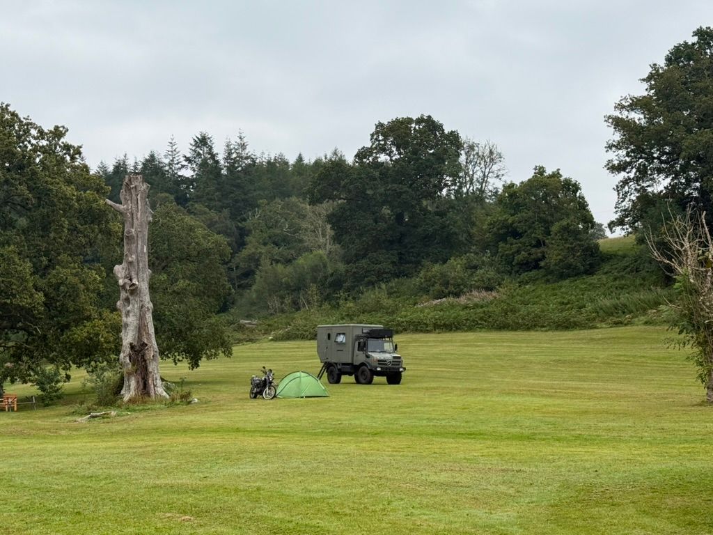
After a 6-hour trek across the ridges of Cader Idris, there is nothing better than coming back to a site that understands the needs of adventurers. Whether you are camping in wales with your motorcycle or staying in our Africa Lodge, we’ve got everything you need to recover.
Our facilities are designed for those who play hard outdoors. From hot showers to our communal fire pits, MotoCamp Wales is the perfect place to swap stories about your climb with fellow hikers and riders.
BEYOND THE MOUNTAIN
While Cader Idris is the "big one," the area around Dolgellau is packed with other adventures. If your legs are too tired for another climb, you can explore the Mawddach Trail for a flat, scenic cycle, or head to the coast for some water sports.
We are proud to be a hub for outdoor hospitality & adventure tourism. Our location puts you right in the mix of the best trails, roads, and peaks that Wales has to offer.
Ready to tackle the Chair of Idris? Book your spot at MotoCamp Wales today and start planning your route. Whether you choose the steps of Minffordd or the classic Pony Path, an epic day on the mountain is guaranteed.
For more local guides and site updates, keep an eye on our blog. We’re always adding new tips to help you make the most of your time in Eryri. See you at the campfire!
Comments